Figure 1. Connected stage scenarios
Reference offset Δh = +4.0 m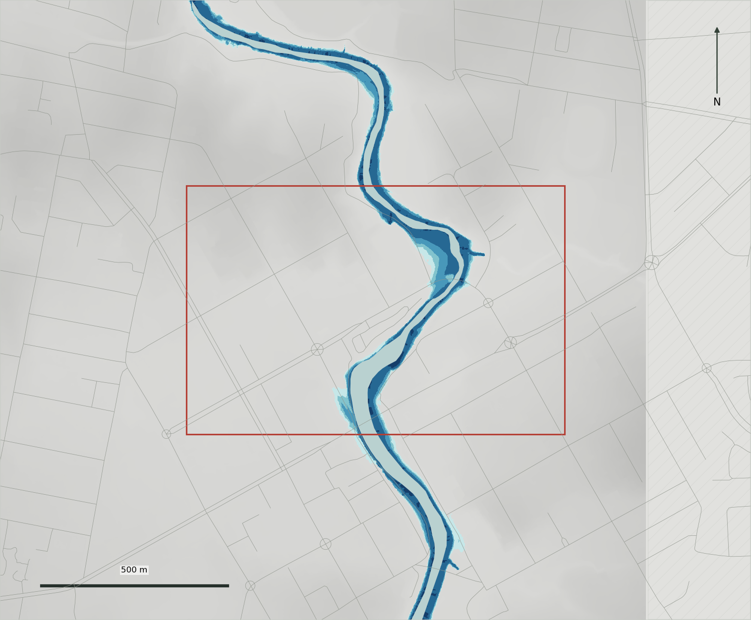
The map image could not be displayed. Reload the file or open the standalone comparison figure.
Open comparison figure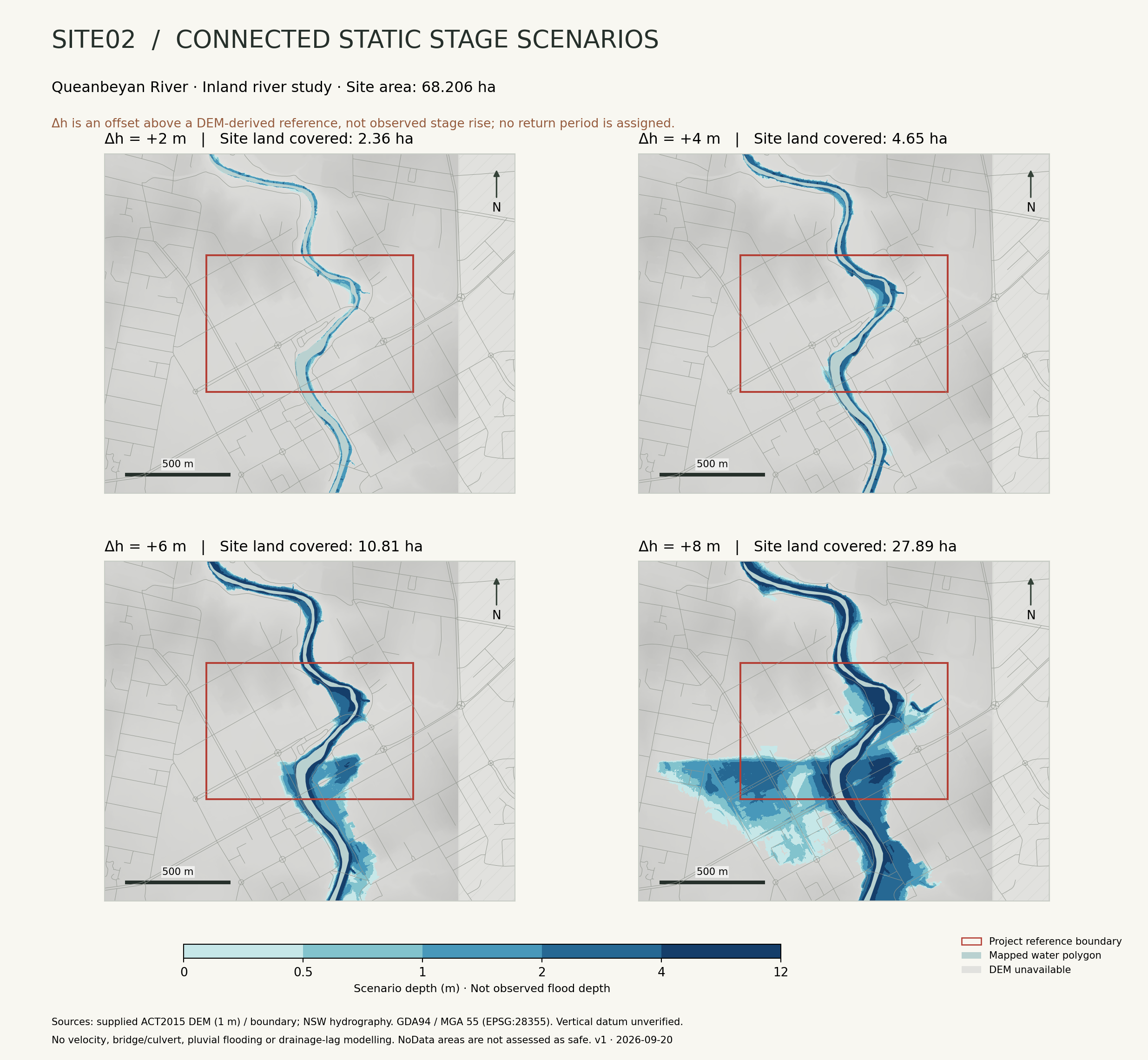
Assumptions remain
part of the result.
The explorer is a terrain-sensitivity study. Use the official 2020 floodplain study for flood-risk interpretation; the constructed offsets do not correspond to annual exceedance probabilities.
Read the complete research guideHow the reference surface is constructed
A 1 m DEM is sampled within mapped water, taking the 20th percentile in each 20 m northing band. A five-band median and non-decreasing southward fit form the profile, which is then extended laterally.
Candidate terrain: Z < Zreference + Δh
Only cells with four-neighbour connectivity to the river are retained. The reference is not an observed water surface or channel-bed survey, and 0 m is not observed normal flow.
Coverage, uncertainty and missing processes
The DEM covers 100% of the site and 86.03% of the model frame. Missing terrain is excluded and must not be interpreted as safe.
The vertical datum is unverified. Flow hydrographs, bathymetry, bridge/culvert hydraulics, defences, roughness and drainage networks are unavailable or unverified. The model does not estimate velocity, arrival time, pluvial flooding, damage or evacuation safety.
Changing the reference percentile from 10 to 50 gives +6 m land-coverage results of 10.60–11.58 ha. This is a method sensitivity range, not a confidence interval.
What rising and falling stage mean here
Playback increases the reference offset and then decreases it. There is no real time axis. The same offset has the same footprint in both directions because residual ponding and drainage are not simulated. This is a property of the method, not a conclusion about actual river behaviour.
Biological records and reuse
GBIF filters retain presence records from 2020 to 20 September 2026 with reported coordinate uncertainty ≤100 m. Records may represent repeated observations of the same individual, and the filter excludes many records without uncertainty values.
The retained records include 2,016 under CC BY-NC, 1,416 under CC BY and 3 under CC0. Respect the licence of each record and acknowledge its original publisher.